GIS Data and Images Showing Threats Posed by Water Hyacinth on Lake Tana
GIS Data
Coverage of water hyacinth
Coverage of water hyacinth at the north-eastern corridor of Lake Tana in Sep 2017.
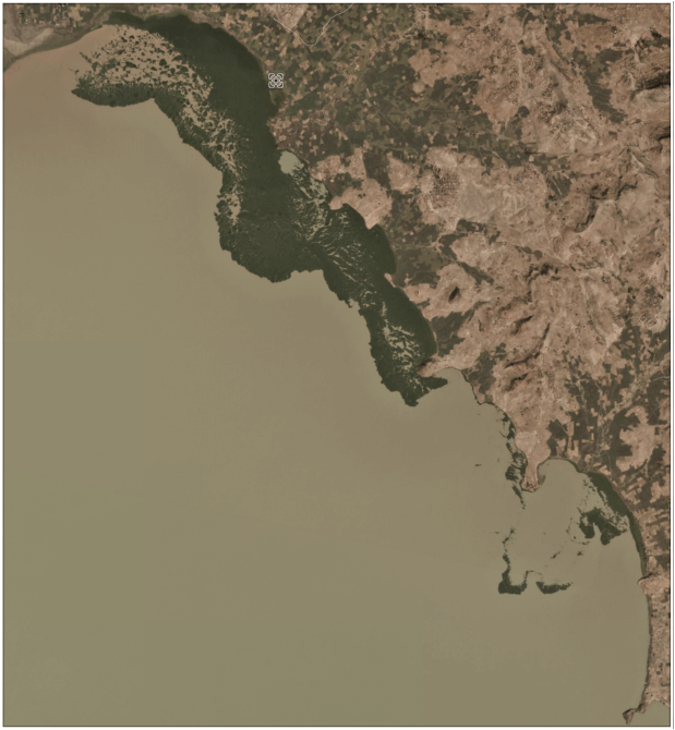
showing movement of water hyacinth
A stellite image showing movement of water hyacinth mat from east to west at the northeastern corner of the Lake
water hwater hyacinth spreading to new areas
Fragments of water hyacinth floating and spreading to new areas using water waves
how turbid the lake's water is
This picture shows how turbid the lake's water is. This is because of high loads of sediment entering the lake through its tributary rivers. Silt accumulation is one of the major risks threatening the lake's water body.
High coverage of Water hyacinth
High coverage of Water hyacinth around Dera (Oct 2017)
water hyacinth colonizing new places
Patchy water hyacinth colonizing new places in Fogera area (Oct 2017)
Flowering water hyacinth
Flowering water hyacinth around Libokemkem woreda (Oct 2017)